Updates
If we have any good news, the counties in the Tampa Bay area are loosening restrictions
and allowing a lot more options for exercising. Here are some updates:
Hillsborough county
Pasco county
Pinellas county
The Southwest Florida Water Management District (SWFWMD)
has created and excellent website that
that lists the status of 69 recreation lands in Southwest Florida,
including the metropolitan Tampa Bay region. In addition, there are links
to each site providing details such as location, maps and trail mileage.
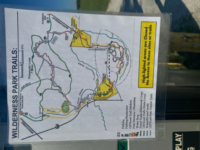
Wilderness Park . The map below shows that Flatwoods and the Morris Bridge Biking area are now open.
All else is closed.
Hidden Gems
Since I live in New Tampa, I thought I would share a couple of sites that are not well known but within a reasonable driving distance.Old Fort King Trail -paved portion This 2.2-mile trail parallels Route 301 and is rarely crowded. There is good tree cover hugging the eastern side of the trail, so you can enjoy shaded exercise for much of the morning. A nice feature is the three beautiful wooden bridges. There are a few cross streets, but the traffic is very light. Normally, you could park at John Sergeants Park (the southern trailhead), but it is currently closed. However, there is a small parking lot (paved and grass) on the north end of the trail. It is located on Route 301 about 5.7 miles north of Fowler Avenue, just past the two yellow signs indicating a trail crossing.
The following two trails are fantastic if you enjoy shady well-maintined forest trails!
Old Fort King Trail -unpaved portion
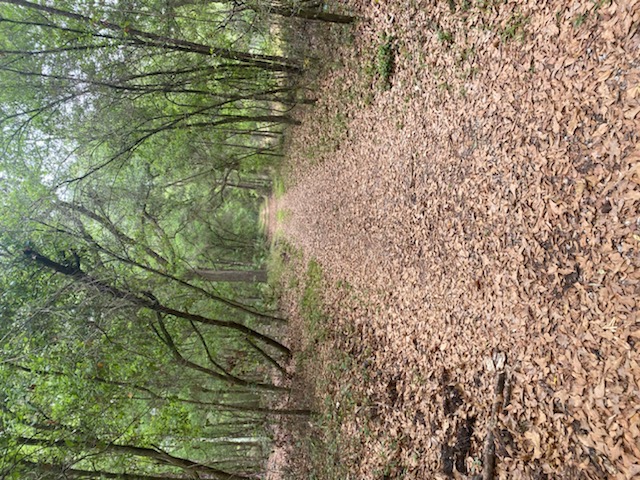
Dead River Park This is another great surprise. The heavily shaded dirt/gravel trail extends for 2 miles. Combined with the old fort king dirt trail above, you can make it a great 5.4 mile trek. Theoretically, you could make a loop back to the old fort king trail using the fisherman’s trail (aka river trail), but I have been told that that this segment is badly overgrown.
Give us your Feedback
Feel free to provide comments or suggestions and updates so we can share your ideas! Enjoy the outdoors and good health to all!